ENTERPRISE GIS
Full Stack Support
We provide Enterprise GIS Support from start to finish.
Whether you need support for a mobile GIS data collection project to configuring Enterprise geodatabases and public-facing web applications used by major US Cities, Utilities, DOTs and Corporations - our team has the skill and expertise to manage the hardware, networking, security and data integrity for your project.
Evari is a proud member of Esri and AWS’ partner networks.
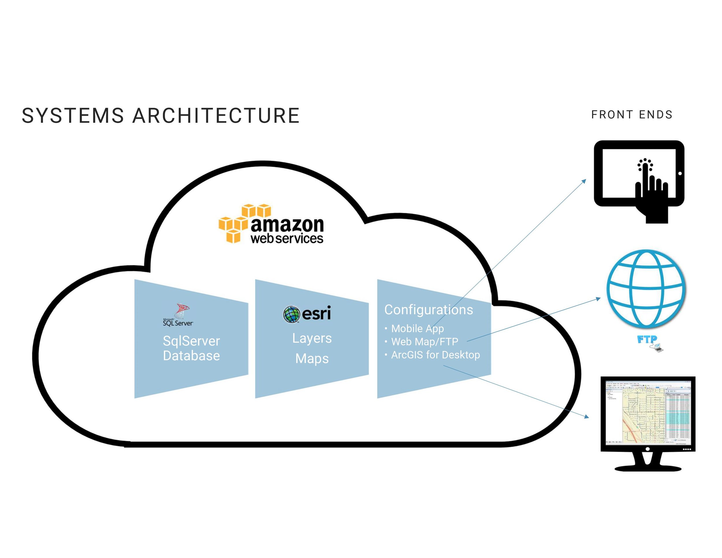
Systems Architecture
Evari has extensive experience in leveraging cloud-based GIS solutions to deliver innovative and efficient services.
Over the last 10 years we have successfully implemented numerous projects using ArcGIS Enterprise on Amazon Web Services (AWS) as well as ArcGIS Online.
Our commitment to leveraging the power of cloud-based GIS has resulted in significant improvements in project delivery times, cost savings, and enhanced data-driven insights for our clients.
Database Design Best Practices
Evari’s team of Enterprise GIS Administrators is knowledgeable on database design best practices, ensuring that systems are designed with security and efficiency in mind.
We work with each client to understand the needs of the project to develop the appropriate database design to ensure a successful data hand off after the project is completed.
Full Suite of Esri Apps
Evari can advise on and help implement any of Esri’s applications.
Field Maps
Collect any piece of data in the field, with the ability to take photos and integrate high-accuracy GPS into your workflow. Create custom forms with required or conditionally visible fields to simplify the workflow for field data collection teams.
Survey 123
Simplified and intuitive form-based mobile data collection. Great for capturing survey data in the field. Great for public engagement studies as well as field inspections.
Experience Builder
Create custom web applications with flexible layouts and interactive content. It is designed to integrate seamlessly with both 2D and 3D data, providing a comprehensive platform for building engaging and informative GIS applications.
Dashboards
A powerful tool that allows users to create interactive and visually engaging dashboards to display geographic information and data. These dashboards are designed to provide a comprehensive view of data on a single screen, facilitating real-time monitoring, decision-making, and data analysis.
Scene Viewer
Immersive 3D applications that help enhance the end users understanding of spatial data by creating a digital twin to visualize data in 3D.
Workforce
Coordinate field teams with one easy-to-use tool.
Story Maps
Multimedia tool used for communicating spatial concepts, engaging, and inspiring audiences.
Interested in learning more?
Drop us a line if you have any Enterprise GIS questions:


